Wednesday, October 19, 2011

Indo-French satellite to boost climate insight

Indo-French satellite to boost climate insight

Papri Sri Raman

12 October 2011 | EN

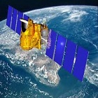
The Indo-French Megha-Tropiques satellite will boost tropical climate climate data.

The Indo-French Megha-Tropiques satellite will boost tropical climate climate data.

CNES

[CHENNAI] A newly launched Indo-French satellite will help scrutinise weather over the tropics in detail and permit better understanding of the monsoon, cyclones and floods.

The one-tonne ‘Megha-Tropiques’ (Megha means cloud in Sanskrit) was launched along with three other smaller satellites on an Indian rocket ‘Polar Satellite Launch Vehicle’ this week (12 October) from the Indian space port of Sriharikota, an island in the Bay of Bengal, 90 kilometres off Chennai.

The new satellites would help study greenhouse gases, vegetation and land use, and help locate ships at sea.

Megha-Tropiques, perched at an angle of 20 degrees, 867 kilometres above the earth, and orbiting the earth five times daily in a north-south direction, will gather data on clouds including ice formation, water vapour and solar radiation, in a three-year experimental mission.

"It opens up a new era of atmospheric research in the tropical system," Indian Space Research Organisation (ISRO) chairman K. Radhakrishnan said after the nationally televised launch. "This mission will provide a lot of information about the tropical regions and how it contributes to global weather."

The French National Space Centre (CNES) and ISRO jointly developed the instrument for ‘Microwave Analysis and Detection of Rain and Atmospheric Structures’ to study clouds in detail, including ice formation.

CNES separately developed the Sondeur Atmosphérique du Profil d'Humidité Intertropicale par Radiométrie (SAPHIR) payload to study water vapour, and Scanner for Radiation Budget Measurement (SCARAB) to study radiation.

"It is part of a constellation of the Global Precipitation Mission (GPM), an international cooperative mission to track precipitation, such as rainfall and snowfall, around the world," a senior scientist from CNES said after the launch. The GPM is run by the National Aeronautics and Space Agency of the United States and the Japanese Aerospace Exploration Agency.

According to CNES, the data would help scientists understand the processes leading to dramatic weather events affecting the tropical countries, such as hurricanes, systems producing heavy rainfall and processes governing monsoon variability or droughts.

Extreme events such as the El Nino of 1997-98, repeated droughts across parts of Africa, and the Atlantic hurricanes are linked to changing climate trends and point to the importance of studying tropical weather systems in the context of climate change, CNES said.

Roddam Narasimha, chairman from the Indian scientific group for Megha-Tropiques, told the daily, 'The Hindu', that scientists worldwide have not been able to "cash in on the predictability" of tropical weather because global prediction models are not as efficient over the tropics as with higher latitudes.


Source:- http://www.scidev.net/en/south-asia/news/indo-french-satellite-to-boost-climate-insight.html

Tuesday, October 18, 2011

ADB President Visits India to Mark 25 Years of Partnership

MANILA, PHILIPPINES – Asian Development Bank (ADB) President Haruhiko Kuroda will begin an official visit to India from 17 October to mark 25 years of development partnership between India and ADB.

During his three-day visit, Mr. Kuroda will join senior Government leaders at a commemorative ceremony, and participate in discussions on the long-term development challenges and opportunities facing Asian countries at the Eminent Persons’ Forum in New Delhi. Both events are jointly organized by the Government of India and ADB.

“ADB’s operations in India have steadily grown over the last 25 years. President Kuroda’s visit reflects ADB’s strong partnership with India and our continuing commitment to support the Government’s efforts to achieve inclusive and sustainable growth,” said Hun Kim, Country Director of ADB’s India Resident Mission.

While in India, Mr. Kuroda will also visit ADB-funded urban development, road and energy projects in Madhya Pradesh and meet senior officials from the state.

ADB began its operations in India in 1986. The relationship between both partners goes back much further, as India was one of the founding members of ADB in 1966.

Between 1986 and 2010, ADB has supported over 150 projects across eight sectors, with an estimated cost of $24 billion. ADB's projects are spread across over 20 states of the country.

ADB recently approved a new three-year country operations business plan for 2012-2014 that will provide lending assistance of $6.25 billion to support inclusive and sustainable growth in the country.


http://cdrn.org.in/show.detail.asp?id=22659

Monday, October 10, 2011

Sikkim quake unique


The recent 6.9-magnitude earthquake in Sikkim, which claimed more than 100 lives, was different from most temblors that had rocked the Himalayan region.

It did not occur on the well-known thrust faults formed due to under-thrusting of the Indian plate below the Eurasian plate as in 95 per cent of the major earthquakes in the Himalayan region. Instead, it occurred between two transverse faults represented by Tista and Gangtok lineaments where two segments of Himalayas have moved in a horizontal direction.

Although the transverse faults were also the result of under-thrusting of the Indian plate, this was the first time that a major earthquake had occurred along them in Sikkim region, according to R.K. Chadha, Chief Scientist, CSIR-National Geophysical Research Institute (NGRI) which deputed a team of five scientists to the affected region following the earthquake to carry out field investigations. The team has set up a network of four broadband seismic stations. The earthquake with its epicentre located 68 km of northwest of Gangtok occurred at a depth of 20 km beneath the Himalayas.

Seismically very active

With the Himalayan region being one of the most seismically active places in the world, the recent earthquake, however did not come as a surprise. Most other major earthquakes above magnitude (M) 8.0 in Shillong (1987), Kangra (1905), Bihar-Nepal border (1934), Arunachal Pradesh (1950) and many others between M 6 and 7 were caused by faults formed by the under-thrusting of Indian plate below the Eurasian plate. The Sikkim region experienced relatively moderate seismicity over the past 35 years with temblors of M 5 or greater occurring within 100 km of the epicentre of the September 18 event.

Large area impact

Dr. Chadha said another interesting feature of the recent earthquake was that it was felt over a large area, including Delhi and other major cities such as Lucknow, Patna and Ranchi along the Indo-Gangetic plains. With most of the region lying in the soft sediments in the Indo-Gangetic plains and the Brahmaputra Valley, the earthquake was felt strongly as the seismic waves get amplified in soft sediments when compared to hard rock regions. As experienced earlier, such temblors would cause damage in faraway regions too due the amplification process. The amplification phenomenon again showed that major cities located in the Indo-Gangetic plains face greater earthquake hazard than other regions.


For Situation and Assessment report for Sikkim Earthquake please log on to :- http://cdrn.org.in/blog/wp-content/uploads/2011/09/Himalayan-Sikkim-Earthquake-Situation-Report-2011CDRN.pdf

View a detailed Situation Report and Need Assessment for the immediate and long term recovery plan for the affected in the Himalayan Earthquake and le

View a detailed Situation Report and Need Assessment for the immediate and long term recovery plan for the affected in the Himalayan Earthquake and learn how you can help!

Monday, October 3, 2011

Himalayan Earthquake 2011 (Nepal / Sikkim Earthquake)

Himalayan Earthquake 2011 (Nepal / Sikkim Earthquake)

Himalayan Earthquake 2011 (Nepal / Sikkim Earthquake)

Read A detailed report on the earthquake (M:6.8) of 18th September, 2011 at Sikkim-Nepal border region at http://www.cdrn.org.in :-

http://www.cdrn.org.in/upload/file/Detailed%20Report%20on%20Sikkim%20Earthquake.pdf

An earthquake of magnitude 6.8 occurred on 18th September at 18:11 hrs IST in Sikkim-Nepal Border region. The preliminary hypo-central parameters of this earthquake, as estimated by the Seismic Monitoring Network of India Meteorological Department (IMD) are given below: Date of occurrence : 18/09/2011 Time : 18:11 hrs (IST) Magnitude : 6.8 Focal depth : 10 Km Epiecentre Latitude & Longitude : 27.7oN & 88.2 oERegion : Sikkim-Nepal Border region.

http://cdrn.org.in/blog/index.php/himalayan-earthquake-sikkim-earthquake-north-east-india/

How You Can Help, Himalayan Earthquake, Sikkim Earthquake Relief Appeal

View specific needs from the affected communities in Sikkim

http://cdrn.org.in/show.needs.asp

Saturday, October 1, 2011

Himalayan Earthquake 2011 (Nepal / Sikkim Earthquake)

Himalayan Earthquake 2011 (Nepal / Sikkim Earthquake)

Read A detailed report on the earthquake (M:6.8) of 18th September, 2011 at Sikkim-Nepal border region at http://www.cdrn.org.in :-

http://www.cdrn.org.in/upload/file/Detailed%20Report%20on%20Sikkim%20Earthquake.pdf

An earthquake of magnitude 6.8 occurred on 18th September at 18:11 hrs IST in Sikkim-Nepal Border region. The preliminary hypo-central parameters of this earthquake, as estimated by the Seismic Monitoring Network of India Meteorological Department (IMD) are given below: Date of occurrence : 18/09/2011 Time : 18:11 hrs (IST) Magnitude : 6.8 Focal depth : 10 Km Epiecentre Latitude & Longitude : 27.7oN & 88.2 oERegion : Sikkim-Nepal Border region.

http://cdrn.org.in/blog/index.php/himalayan-earthquake-sikkim-earthquake-north-east-india/


How You Can Help, Himalayan Earthquake, Sikkim Earthquake Relief Appeal

View specific needs from the affected communities in Sikkim

http://cdrn.org.in/show.needs.asp